Quito
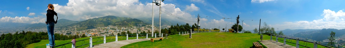
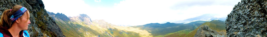
 overlooking the old city
 We spent the last week or so in and around Quito, the highest city in Ecuador (at 2800 metres above sea level). With a population of about two million it’s a reasonably large city, though the surrounding mountains squeeze it into such a long and narrow shape that it can take hours to travel from one end to another. Despite our general dislike of large cities, we actually enjoyed a couple afternoons wandering around and taking in the sights: epic churches, interesting museums, huge parks, artisanal markets, and interesting architecture - oh, and there’s also a pub with craft beer which is a much needed change from the usual boring Ecuadorian beer.
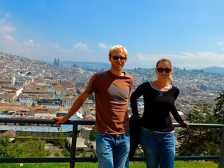
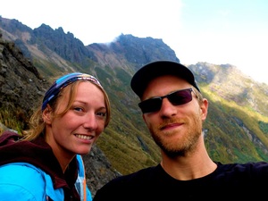
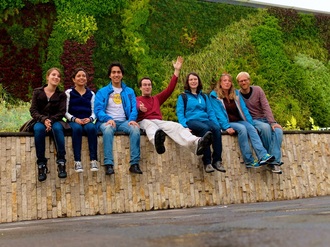 chillin' with some of the IAESTE crowd
 One of the main reasons we decided to visit Quito is because a friend of mine, Michael-Anthony (usually just “M.A.”) happened to be here for an IAESTE (International Association for the Exchange of Students for Technical Experience... phew!) conference. M.A. and I have shared some other interesting coincidences in the past – on my first day of work during my IAESTE internship in Vienna in 2007, I walked into the office only to find M.A. (who was also taking Mechanical Engineering at UofT) sitting at the desk beside mine. For whatever reason, we had to travel halfway around the world to become friends, and had soon drank half the beer in Austria and formed an impromptu band with a couple other interns... some great memories. It was nice to spend some time catching up and taking in some of the sights. He also snuck us onto a bus tour and scored us a free lunch, helping us pose as conference attendees. =)
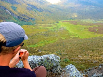
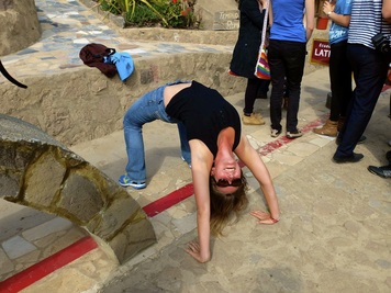 will the Coriolis forces tear her torso apart??
 The center of Quito is located about 25 km south of the actual equator, and one of the more interesting stops on the bus tour was at “la mitad del mundo” – a site marking the location (or close enough) of the actual equator. Our tour guide eagerly demonstrated some of the phenomena associated with being on the equator, most of which M.A. and I, being rational engineers, tried to debunk. The one that really irked us was the demonstration of water draining in a sink, with the direction changing due to the Coriolis Effect. The demonstration showed that the same sink drained differently depending on where it was placed: directly on the equator (draining straight down), ten feet north of the equator (draining counter-clockwise), and ten feet south of the equator (draining clockwise). At first we were a bit baffled, but upon looking closer we noticed that the guy leading the show was totally cheating!! Before draining the sink on the equator, the water was left for a few minutes to make sure it was completely still, but right before the demos off of the equator the water was poured from a bucket in such a way as to already get the water moving in the right direction. Poppycock, I say! Once the demo ended, we stepped in and were able to, by pouring from the bucket in the right way, get the water to drain the opposite way it was supposed to. BAH. I’m not disputing the Coriolis Effect, I’m just saying there’s no way it can make a difference over such a small scale… anyways, maybe we were taking things too seriously.
Cotopaxi National Park
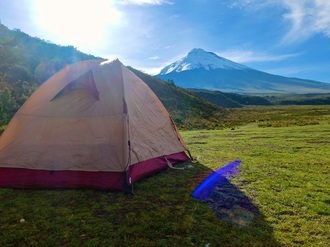 our mountain home
 The other reason we came to Quito is its proximity to Cotopaxi National Park, about fifty kilometres south of Quito and the home of Cotopaxi, Rumiñahui, and Sincholagua volcanoes, with Cotopaxi being among the highest active volcanoes in the world. If you’ve been keeping up with our adventures so far, you’d know that we were way overdue for a volcano hike, though the high elevation made this one a much different experience from La Concepción and Telica (Nicaragua) and Arenal (Costa Rica).
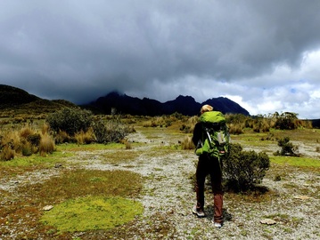 like another planet!
 At first we looked into climbing the glacier-peaked Cotopaxi, but were quickly turned off by the prices – this would be a relatively serious trip and would require renting ice-hiking equipment, hiring guides, etc. With a bit more research, however, we learned that it’s possible to make your own way up into the national park to camp and hike up the neighboring Rumiñahui. We thought we’d give it a go, so we packed up all our warm clothes (which up until now we’ve been lugging around for no reason), stocked up a couple days’ worth of groceries (oatmeal, veggies, lentils & pasta), filled up the camp stove with some gasoline that the hostel cleaning lady happened to have in the back room (?), and hit the road. About an hours’ bus ride later, we found ourselves at the park entrance (at an elevation of about 3200 m) and confronted by a line of pickup trucks (camionetas) hoping for a fare. I know we promised Oma not to hitch-hike, but this really doesn’t count – besides, it would’ve taken us all day to hike up! So, for $20 we caught a ride up to the camping area in between Cotopaxi and Rumiñahui, at an elevation of about 3500 m.
 approaching the rocky peaks
 The scenery was utterly breathtaking, and it was incredible to be able to simply pitch our tent in a field so close to the base of both volcanoes and just take in the view (while we struggled to take in a decent lungful of air). With the exception of a few excellent times in Byron Bay, Australia (wink, nudge) this was the highest we’d ever been and we could really feel the difference in the air. Even after spending four days in Quito at 2800 m, it took next to nothing to get out of breath and we were forced to walk around at a snail’s pace. The chilly mountain air also caught us a bit off guard – even though we had packed all the warm clothes we brought (which for me meant a layer of fleece under my man-yoga pants, long-sleeved shirt and rain jacket), we were still mighty chilly at night when the temperature dropped down to just a few degrees above freezing. I was grateful that I’d splurged on the $25 toque at the adventure outfitters in Quito.
 capturing our GPS coordinates from the almost-top
 After spending our first chilly night in the park, we set off to make the trip up the rocky-peaked Rumiñahui. The terrain up there is so unique – something between arctic tundra and the surface of Mars – in a way it reminded us a lot of hiking in the Tombstone Mountains in the Yukon. Lots of lichen, some grassy knolls, and tons of strange desert-like shrubs. As we made the steady climb we lost the trail a bunch of times, but by continuing to head toward the obvious rocky peaks managed to pick it back up again when we needed it. After a slow and wheezy four hours, we found ourselves staring up at the three jagged peaks of Rumiñahui, wondering how the hell the trail would get us to the top. After hiking about half an hour more, although it was tempting to scramble our way to the very peak (we were so close!), common sense and lack of climbing equipment dictated that we instead stop, find a safe spot to sit, and take in the gorgeous view and complete silence. Our GPS beacon tells us we made it to an elevation just shy of 4300 meters, not too shabby!
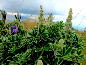 neat fuzzy-leafed plant
 The hike back down was much easier, taking less than two hours despite a couple significant deviations from the actual trail. We found that even after descending only a few hundred feet we were no longer short of breath, which was a relief. One of the best parts about the hike for me was the fact that, despite how incredible the scenery and experience was, we didn’t see another living soul the whole time (sorry Chelsea, but it’s a known fact that animals don’t have souls).
After cooking up a delicious batch of veggies, beans and rice, and then tossing and turning through another chilly night, we made the trip back down to the park entrance. Because the drive up seemed so short, “it couldn’t have been more than 8 or 9 km...” we decided to save the $20 ride and instead just hike out. Eighteen kilometers and four hours later, we’d discovered a whole new group of leg muscles and learned that these muscles hurt for days after a long downhill hike. The twisted priorities of a backpacker...
After cooking up a delicious batch of veggies, beans and rice, and then tossing and turning through another chilly night, we made the trip back down to the park entrance. Because the drive up seemed so short, “it couldn’t have been more than 8 or 9 km...” we decided to save the $20 ride and instead just hike out. Eighteen kilometers and four hours later, we’d discovered a whole new group of leg muscles and learned that these muscles hurt for days after a long downhill hike. The twisted priorities of a backpacker...
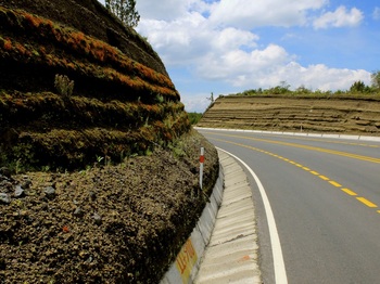 the long road back down
 All in all, we’ve both really enjoyed the last ten days in Baños and Quito and are now completely back into the swing of things. Our opinion of Ecuador has also improved a few notches, especially after the whole Montañita fiasco. From here, we’ll make our way back down to Coca and work on getting ourselves into the jungle! In the meantime…
Keep bein’ chili!
~ Mandrew
Keep bein’ chili!
~ Mandrew
Photos - Quito, Ecuador
To open Quito slideshow in another window, click here.
Photos - Cotopaxi National Park
To view Cotopaxi slideshow in another window, click here.
 RSS Feed